A rare encounter with a juvenile great white shark has renewed scientific interest in one of the Mediterranean Sea’s most elusive marine predators, raising fresh questions about whether a hidden population may still persist in the region.
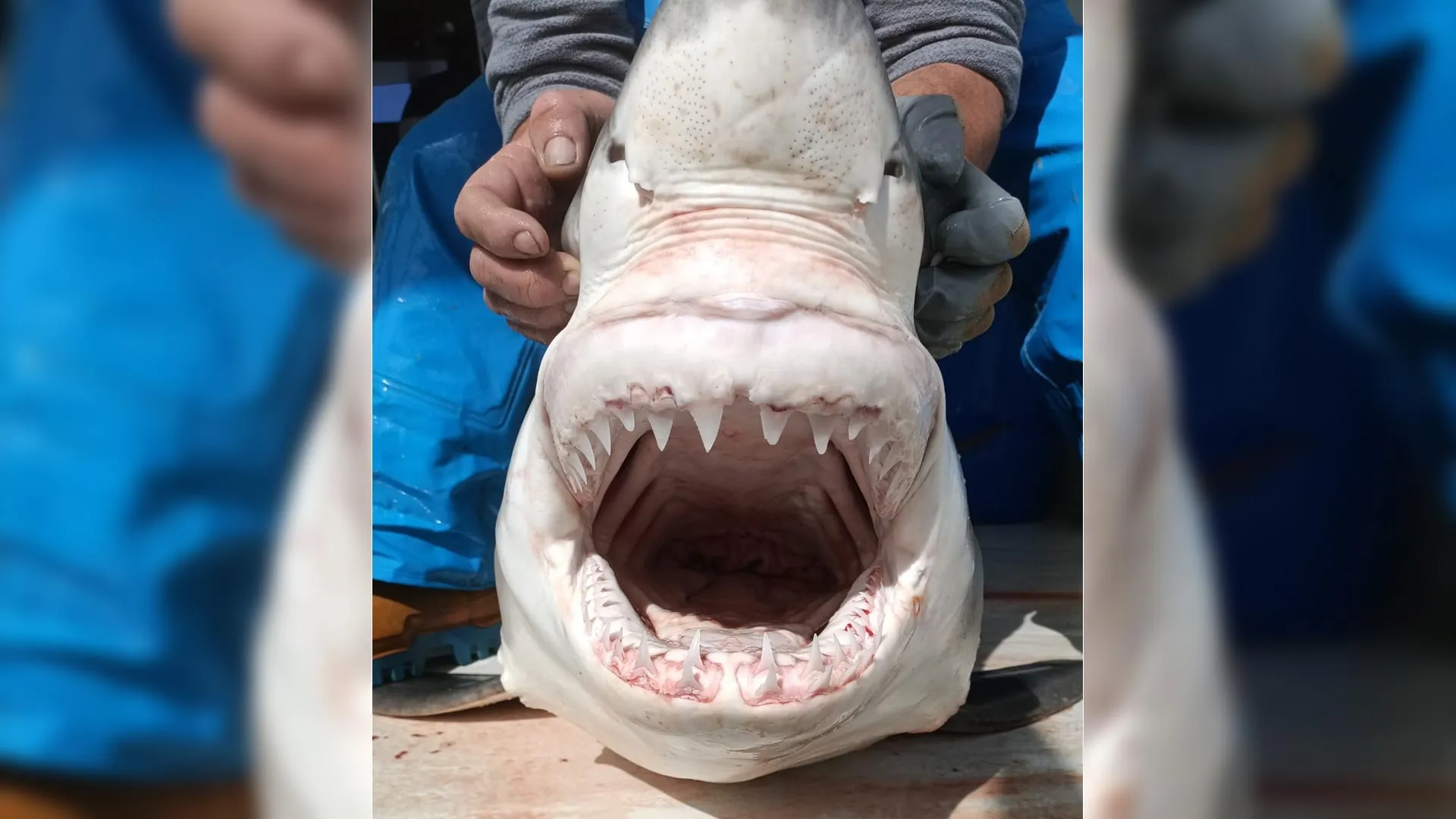
The incident, reported by Pensoft Publishers, took place on April 20, 2023, when local fishermen accidentally caught a young shark off the eastern coast of Spain. The juvenile measured approximately 210 centimeters in length and weighed between 80 and 90 kilograms.
While the physical encounter occurred in 2023, the full scope of the discovery was only revealed on January 27, 2026, when the formal peer-reviewed study was officially published in the scientific journal Acta Ichthyologica et Piscatoria. Following its academic release, global science media broke the story to the public in June 2026, shedding light on the extensive analysis that followed the initial catch.
Although great whites are among the most well-known marine predators worldwide, confirmed sightings in the Mediterranean remain extremely uncommon.
For decades, scientists have debated whether these occasional records represent a small surviving local population or simply individual sharks moving in from the Atlantic Ocean.
What makes this discovery particularly significant is the age of the animal. As a juvenile, it raises the possibility that great white sharks may not only be passing through Mediterranean waters but could also be reproducing in the region, challenging long-standing assumptions about their presence there.
Following the capture, researchers spent nearly three years reviewing more than 160 years of historical records, including sightings, captures, and stranding reports dating back to 1862. Their analysis suggests that while these apex predators remain rare in the basin, their occurrence may be more consistent than previously assumed.
However, scientists emphasize that the evidence is still limited. A single juvenile sighting is not sufficient to confirm a stable breeding population. They also note that factors such as fishing pressure, habitat changes, and broader ecosystem shifts over time may have influenced shark distribution patterns.
Despite the uncertainty, the discovery has renewed scientific attention on the species and highlights the need for further research, including genetic studies and long-term tracking. For now, the “ghost” great white shark remains an enduring mystery, an example of how much the ocean still holds yet to be fully understood.