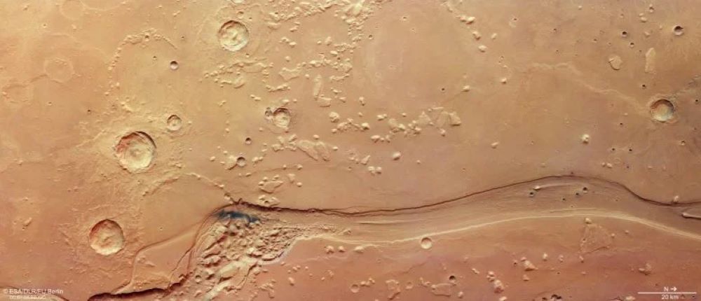
The images were captured by the Mars Express spacecraft, which has been studying Mars since 2003. They focus on Shalbatana Vallis, a huge valley near the Martian equator stretching about 1,300 kilometers, roughly the length of Italy.
Scientists believe the valley formed around 3.5 billion years ago when large amounts of underground water suddenly burst through the planet’s surface. The powerful floods are thought to have carved deep channels as water rushed across the landscape.
Parts of the valley are around 10 kilometers wide and up to 500 meters deep. Researchers say the channel may once have been even deeper before sediments and dust partially filled it over time.
The area also contains signs of volcanic activity, impact craters and collapsed rocky terrain. Dark patches seen in some images are believed to be volcanic ash later spread by Martian winds.
Shalbatana Vallis leads toward Chryse Planitia, one of the lowest regions on Mars. Because many large channels end there, some scientists think the area may once have held a huge ocean when Mars was warmer and wetter than it is today.
The images also reveal smooth surfaces likely formed by ancient lava flows, along with hills and ridges shaped over billions of years.
Scientists say the findings continue to provide important clues about the geological history of Mars and the possibility that water once existed in large amounts on the planet.
Leave a Reply