Traditionally, observing ocean currents, especially the small, rapid ones has been extremely difficult. Satellites can measure large‑scale patterns like sea surface height, but they revisit the same area only every several days, leaving a gap in our view of fast‑changing and smaller features.
Now, a team from the University of California‑San Diego and collaborators have cracked this challenge by combining weather satellite images with advanced machine learning.
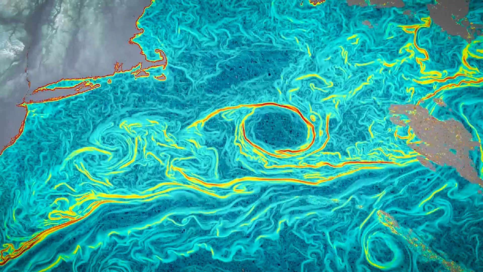
The method, dubbed GOFLOW (Geostationary Ocean Flow), analyzes consecutive thermal images from weather satellites images originally designed to track clouds and temperature and turns them into detailed maps of ocean movement.
By training a deep learning model to recognize how temperature patterns shift over time, researchers can infer how the underlying water is flowing.
According to the lead researcher, Luc Lenain from the Scripps Institution of Oceanography, “Weather satellites have been observing the ocean surface for years. The breakthrough was learning how to turn that time‑lapse into hourly maps of currents.”
This statement highlights how the team transformed ordinary satellite data into something far more powerful viewing currents as if watching a movie of the ocean itself.
This AI‑driven system doesn’t require new or costly satellites. Instead, it maximizes the value of existing orbiting weather instruments, making the approach both efficient and cost‑effective.
It can detect fast‑moving currents and small eddies swirling water features previously hidden from direct view which are crucial for understanding vertical mixing.
Vertical mixing is a key process that brings nutrients from deep waters up toward the surface and helps store carbon in the ocean both essential for marine life and climate regulation.
The research team also includes Kaushik Srinivasan, a former Scripps researcher now at UCLA, as well as Roy Barkan of Tel Aviv University and Nick Pizzo of the University of Rhode Island. Their findings were published in Nature Geoscience, a leading scientific journal.
Because the new technique works with existing geostationary satellites which constantly observe large parts of the Earth, scientists hope GOFLOW could soon be integrated into climate models and weather prediction systems, improving forecasts and helping us better understand ocean‑climate interactions.
This AI‑powered discovery offers a detailed and dynamic look at ocean currents for the first time, turning everyday satellite data into a powerful tool for science, climate study, and environmental monitoring.
Leave a Reply